A Brief History of the City of Hazel Park
Information compiled by Richard E. Robbins
Early Years 1800-1923
THE HISTORY OF HAZEL PARK, MICHIGAN begins with Native Americans that hunted and lived on the land Hazel Park lies on. Stone artifacts from prehistory, such as arrowheads and other implements, were found in excavations throughout the area.
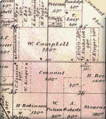
Hazel Park starte its official life as Royal Oak Township in 1833, when Shuabel Conant became the first landowner in 1835 with a grant from the U. S. Government. Conant and his heirs sold off parcels of land to settlers. Among the settlers were the Lacey, Grix, Benjamin, Neusius, Meinke, Grow and Truba families. Many street names, schools, and parks were named for these and other pioneer families in the area.
The naming of Hazel Park has two competing origin stories. The first is attributed to the real estate developer Burnette Fechette Stephenson, for whom the Stephenson Highway was named. He, per his son’s obituary, named the Hazel Park Subdivision for his future wife, Hazel Kirk. Howard H. Beecher penning in a paper for his college degree, stated, “The name was given to the area by a real estate company at the time it was bought and subdivided.” The name Hazel Park was also opposed by newspapermen in editorials, as it had an association to the developers of subdivisions in the city and it was felt that the city should have a clean start.
A second naming origin story has its roots in the Hazel brush shrubberies found in Oakland County. The shrubbery was mentioned to also be around Pontiac in the 1912 History of Oakland County, and per some accounts, to be quite abundant around Royal Oak Township’s lowlands. The name of the school district was purportedly named after the hazel brush plant, but that may have been the name of the one-room school house located at 9 Mile and John R’s south west corner. The Hazel Park school district did not get its official name until sometime in the 1940s or ‘50s.
Extensive research has concluded that the stories could both be true. The developer B.F. Stephenson could have adopted the name used by the schools for use in his subdivision, overlaying that named sub over his existing 9-Oakland sub, naming the subdivision for his fiancée.
The area where I-75 lies today was also purchased and developed by B.F. Stephenson, as an area where the Stephenson Line trolley was created around 1916. The trolley reportedly used to fall off the tracks around Goulson Street, according to some accounts. It was removed after 1931, after the closing of the Highland Park Ford plant. It then became the right-of-way for Stephenson Highway, and later I-75. The “S” curve in I-75 is there because the land was not available to B.F. Stephenson and his partners for a straight track run to 4th street in Royal Oak!
Growing Pains 1923-1941
AS AN EXTENSION OF THE EXPLOSIVE GROWTH of the North Woodward area and Highland Park, Hazel Park was “discovered” after a section of Woodward was closed due to construction in 1922. Motorists redirected to John R found an affordable new area with subdivisions in the process of construction. Quickly, the population grew. Henry Ford’s Highland Park plant started operations about 1914, providing jobs for the new residents of Hazel Park. Other subdivisions came into being, with some areas having modest homes built by the people attracted by the wages paid at the Ford plant in Highland Park. Because of the high cost of land in Detroit at the time, the Hazel Park area became an alternative to Detroit. Many early landowners attached family names to streets, including Andresen Court. Many families built homes on weekends and, as the area was unincorporated, zoning and building standards were rather lax.
These were not easy times for the residents of Hazel Park. As Hazel Park was not an incorporated city at the time, the area suffered due to lack of infrastructure. According to Howard H. Beecher, at one point, Hazel Park was the most populous unincorporated area in the country. The following was written about the area in 1928 by Beecher (who later became the principal of Hazel Park High School).
“The housing conditions are bad in some parts of Hazel Park. There are many modern well-kept homes with five or six rooms and quite a large number of modern, two-family income bungalows. On the other hand, there are many garage homes that have only two or three rooms. I have no data so I cannot compute the house congestion but I do know that in many of these small houses, father, mother, and five or six children have to live. It is hard to conceive of the conditions that the school nurses tell about in their report.”
Many busine
sses sprang up in the business district both north and south on John R, as well as on other major arteries including 8 Mile Road and Stephenson Highway. Many stores, restaurants, and theaters were constructed in the city. Boxing matches were held in an arena on John R. Hazel Park Bowl had a facility on John R. Many churches were also constructed, and expanded, as the population grew.
During this time of unregulated growth, the Hazel Park School District grew as well. From the initial one-room schoolhou
se on the southwest corner of John R and 9 Mile (later moved to become Frank Neusius’ barbershop and store), the district embarked on a building campaign. Construction of Lacey School, United Oaks Elementary, and Wanda Elementary began. The old Hazel Park High School (which became Howard H. Beecher Junior High in 1965) was added in 1929.
While times were tough, the citizens improved the area through their own efforts. Clubs like the Hazel Park Exchange Club were responsible for improvements including the first traffic signal, a police booth, and various other civic improvements. Through the Great Depression, the area suffered greatly. Various attempts to incorporate failed, and various attempts by both Detroit and neighboring Ferndale to annex also failed for various reasons. Newspapers came and went in the Hazel Park area as well, some with a purely political agenda. The Hazel Park Palladium, also known as the Hazel Park News, was one of the longest-lasting, publishing through 1978.
Birth of a City 1942-1960
THE YEARS LEADING TO THE OUTBREAK OF WORLD WAR II brought about great changes to the Hazel Park area. The war effort, as in many other cities, involved scrap drives and other cooperative efforts to defeat the Axis Powers. A consensus of the benefits of civic cooperation also took hold. The citizens began constructing a new library building on East Pearl and Rhodes. Spearheaded by John D. Erickson, the citizens held card parties and various fundraisers to pay for the construction and furnishing of the new library.
In 1941, the citizens finally decided the time was right for incorporation, and on February 2, 1942 the city incorporated. The first council meeting was held in the foyer of the Hazel Park City Library (which was renamed the John E Erickson Memorial Library after John E. Erickson’s death in 1948).
After WWII, the city continued to grow in population. More homes were built, and the business district grew. The addition of the Hazel Park Raceway in 1948 was instrumental in the city’s growth. By providing additional revenue, it solidified the financial situation of the city for many years.
City services, such as enhanced park programs, a new recreation center, and other benefits for citizens were added during this time. A new city hall was constructed on Stephenson Highway, replacing the old city hall on 9 Mile. Though the city itself was thriving, many problems remained from the years of growth as a township. An “urban renewal” project was undertaken to rid Hazel Park of substandard housing. Thus, the area known as “the Courts” was constructed. These homes, after more than 50 years, are still a fine addition to the city.
Civic Changes 1960-1970
THE 1960S BROUGHT A WAVE OF CHANGE TO HAZEL PARK. The expansion of the I-75 freeway doomed a portion of the business district along John R. The City Hall that was built in the ‘50s was also demolished by this expansion. A new city hall was needed, and the city acted. As the Hazel Park Library was too small for further expansion, it was decided that a new city hall and library were to be constructed at the corner of 9 Mile and John R roads for a new civic center. Designed by Josh Machida of Machida and Associates, both buildings were finished by 1970.
During this same period, Lacey school was demolished on the southwest corner, as well as three city blocks of homes and businesses on the north-west corner of 9 Mile and John R. In its place, a ten-story Holiday Inn hotel was constructed, as well as what became known as Cambridge Mall, with shops and a movie theater included in the development.
The Modern Era 1970-present
THE CITY GRADUALLY BECAME RELATIVELY STABLE during the 1970s, ‘80s and ‘90s. In the late ‘90s and early years after 2000, the city and school district undertook additional remodeling of the city landscape.
Streetscape programs and repaving efforts were undertaken along John R and 9 Mile Roads, installing new decorative street lighting. The city also added a new ice arena along Woodward Heights. The school district remodeled all their elementary schools and the high school, demolished the old Beecher Junior High school and United Oaks Elementary, and constructed a new junior high (same location as the previous junior high), and a new United Oaks Elementary.
The calamitous traffic accident and explosion on I-75, and subsequent destruction of the 9 Mile bridge, in July 2009 was an event few will ever forget. The actions of our city’s first responders that day were memorable, and a shining moment in the city’s history. Another memorable event in the history was the flood of August 2014. This flood mirrored the flood that happened in 1948 in Hazel Park. The response by the citizens and city government shows the great resilience of our city.
New home construction and a large expansion of the Hazel Park Raceway have been bright spots in Hazel Park’s recent history. Remodeling of the business district continues with the addition of a new strip mall on the southeast corner of 9 Mile and John R, replacing what was remaining from the older business district. In Spring of 2010, the former Holiday Inn was demolished for the construction of a new CVS pharmacy. The addition of new restaurants in the area south of Woodward Heights in 2016 is a great starting point for what promises to be a walkable downtown area for the city.
At both ends of the city, new developments are also bringing jobs and people into our city. At 8 Mile and Dequindre, a new Save-A-Lot and other retail buildings are adding businesses to that area. Also, a portion of the Hazel Park racetrack property is being redeveloped at the time of this writing for what will become the largest building ever constructed in the city, and which will house light industrial uses. Expansion of warehouse space along 9 Mile Road is also increasing Hazel Park’s tax base, and a remodeling of the first police station and firehouse on 9 Mile Road is being undertaken as well.
The 43rd District court expansion and the remodeling of the City Hall building will remake the look and feel for the John R/9 Mile Road area. The City continues to change and grow. Hazel Park has proven itself to be adaptable to change, and will continue that tradition in the coming years. While Hazel Park has had a remarkable historical legacy, the city continues to look to the future; ever mindful of our heritage.


